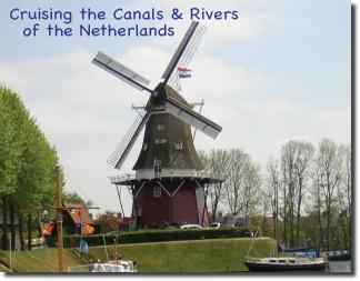
EuroCanals Guides are for planning travels on the inland waterways of France, Belgium, Netherlands and Germany. Published in English, the EuroCanals Guides are used to first make a general plan about where to cruise, then use the guides for reference along the route, on a laptop or tablet. The guides show where you can go with a boat of known size and why you might want to go there; also included are listings of boat brokers, boat builders and boat rental bases. Moorings are listed throughout the four countries, as well as winter storage ports.

The guides are published in PDF format, configured to fit the screen of an iPad in landscape mode. They can be viewed in a desktop or laptop computer, or in a tablet.
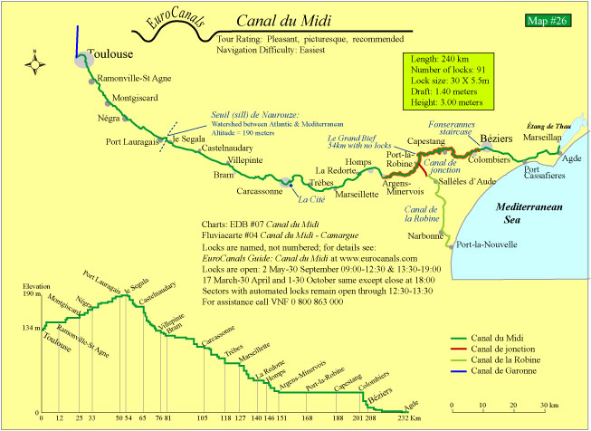
Waterway Details - shown on maps and data tables
Index number, referenced to a map of the country
Length of waterway in kilometers from/to named towns
Number of locks along the waterway
Lock size, width x length in meters
Water draft, in meters
Bridge clearance height, in meters
Elevation charts show the frequency of locks


Tom - As someone who recently bought a canal boat and knows nothing about canal boating in Europe, I subscribed to your online library. Last night I spent about five hours reading about the Netherlands — where my boat is now — and parts of France. Your guides are providing me with exactly the kind of information that I've been looking for but not finding, or at least not finding in such a clear and understandable form, in other books on the subject. In particular, I love the suggested routes for each area, as they give order and clarity to what otherwise would be just be an overwhelming amount of information. Thanks, Richard